Carl Purpus, Plant
Collector in Western America
Carl Purpus, Plant
Collector in Western America By Arnold (Jerry) Tiehm
With additional editing by Barbara Ertter and Tom Schweich
| Carl Purpus, Plant
Collector in Western America | Geographical Index of Carl Purpus -- P |
| By Arnold (Jerry) Tiehm With additional editing by Barbara Ertter and Tom Schweich | |


|
A, B, C,
D, E, F,
G, H, I, | |
|
Query: G.N.I.S. | Pa Ute Peak, California.. | |
|
Letters that refer to this location:
| ||
|
Query: See also: Pauhuca. | Pachuca, , Mexico. | |
|
Letters that refer to this location:
| ||
|
Query: G.N.I.S. | Pacific Beach, San Diego County, California. | |
|
1898, 1899. Types described from this location: | ||
|
Query: G.N.I.S. | Pah Ute, California. | |
|
Types described from this location: | ||
|
Query: G.N.I.S. See also: Beaver Dam Mountains. | Pahcoon Spring Wash, Utah. | |
|
Query: G.N.I.S. See also: Mount Irish. Quartz Spring. | Pahranagat Range, Lincoln County, Nevada. | |
|
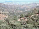
Bounded by Pahranagat Valley on the east and Tikaboo Valley on the west.
1898.
Articles that refer to this location:
Letters that refer to this location: | ||
|
Query: G.N.I.S. See also: Hiko. Hiko Range. | Pahranagat Valley, Lincoln County, Nevada. | |
|
Large valley containing many springs and lakes and is bounded by the
Pahranagat Range on the west and the Hiko Range on the east.
1898.
Articles that refer to this location:
| ||
|
Query: G.N.I.S. 
| Pahroc, Lincoln County, Nevada. | |
|
Query: G.N.I.S. | Pahroc Plains, Lincoln County, Nevada. | |
|
Query: G.N.I.S. 
| Pahroc Range, Lincoln County, Nevada. | |
|
Purpus went into what is now known as the North Pahroc Range
north of highway 93. The range is bounded by the White River to the
west and Dry Lake Valley to the east.
1898.
Types described from this location: Articles that refer to this location:
Letters that refer to this location:
| ||
|
Query: G.N.I.S. | Pahroc Spring, Lincoln County, Nevada. | |
|
Located in the south end of the North Pahroc Range in
T3S, R62E, S25 and at 37° 40'N, 114° 59'W.
1898.
Articles that refer to this location:
Letters that refer to this location:
| ||
|
Query: G.N.I.S. 

| Pahrump, Nye County, Nevada. | |
|
Letters that refer to this location:
| ||
|
Query: G.N.I.S. See also: Spring
Mountains. | Pahrump Valley, Nye County, Nevada. | |
|
On the east side of the Spring Range and east of the Last Chance Range.
1898.
Types described from this location: Articles that refer to this location: | ||
|
Query: G.N.I.S. | Pah-Ute, . | |
| See: Piute. | ||
|
Query: G.N.I.S. | Pah-Ute Peak, Kern County, California. | |
|
Types described from this location: | ||
|
Query: G.N.I.S. | Palmetto, Nevada. | |
|
Letters that refer to this location:
| ||
|
Query: G.N.I.S. See also: Palmetto
Mountains. | Palmetto Mine, Esmeralda County, Nevada. | |
|
Not definitely located but is in either the Palmetto or Magruder Mountains. 1898.
Articles that refer to this location:
Letters that refer to this location:
| ||
|
Query: G.N.I.S. See also: Mt. Palmetto. | Palmetto Mountain, Nevada. | |
|
Letters that refer to this location:
| ||
|
Query: G.N.I.S. See also: Lida. Mount Gabb. Palmetto Mine. Palmetto Range. | Palmetto Mountains, Esmeralda County, Nevada. | |
| Current name for the mountains north of Lida. | ||
|
Query: G.N.I.S. See also: Palmetto
Mountains. | Palmetto Range, Esmeralda County, Nevada. | |
|
Now known as the Palmetto Mountains.
They are south of the Silver Peak Range and east of the Sylvania Range.
1898.
Types described from this location: Articles that refer to this location:
Letters that refer to this location: | ||
|
Query: G.N.I.S. See also: Meadow Valley
Wash.
Hop Creek. Juniper Mountains. | Panaca, Lincoln County, Nevada. | |
|
Along Meadow Valley Wash near the junction of highways 93 & 319.
Centered about T2S, R68E, S9 and at 37° 47'N, 114° 24'W.
1898.
Articles that refer to this location:
Letters that refer to this location: | ||
|
Query: G.N.I.S. 
| Panamint Mountains, Calfornia. | |
|
Articles that refer to this location:
Letters that refer to this location:
| ||
| Query: G.N.I.S. See also: Argus Range. | Panamint Valley, California. | |
|
Query: G.N.I.S. See also: Hot Creek. |
Pancake Range, Nye County, Nevada. | |
|
Bounded by Railroad Valley on the east and Big Sand Springs,
Hot Creek and Little Smoky Valleys on the west.
1898.
Articles that refer to this location:
Letters that refer to this location:
| ||
|
Query: See also: Pachuca. | Pauhuca, , Mexico. | |
|
Pachuca? Letters that refer to this location:
| ||
|
Query: G.N.I.S. | Peloncillo Mountains, Arizona. | |
|
Letters that refer to this location:
| ||
|
Query: G.N.I.S. | Peltah(?) Mountain, La Sal Mountains, Utah. | |
| 1899 (# 6580) | ||
|
Query: | Pena, , Mexico. | |
|
Letters that refer to this location:
| ||
|
Query: G.N.I.S. See also: Sand Springs Valley. | Penoyer Valley, Lincoln County, Nevada. | |
|
Now called Sand Springs Valley it is bounded by the Worthington Mountains
on the east and the Quinn Canyon Range on the west.
1898.
Articles that refer to this location:
| ||
|
Query: | Peria, , Mexico. | |
|
Letters that refer to this location:
| ||
|
Query: G.N.I.S. See also: Picacho Peak. Picacho Peak State Park. | Picacho Mountains, Pinal County, Arizona. | |
| Northwest of Tucson, north of Interstate 10. | ||
|
Query: G.N.I.S. See also: Picacho
Mountains.
Picacho Peak State Park. | Picacho Peak, Pinal County, Arizona. | |
| Thirty miles northwest of Tucson, on both sides of Interstate 10. | ||
|
Query: G.N.I.S. See also: Picacho
Mountains. Picacho Peak. | Picacho Peak State Park, Pinal County, Arizona. | |
| Arizona State Park centered around Picacho Peak, south of Interstate 10. | ||
|
Query: G.N.I.S. | Pico San Lazaro, Baja California. | |
|
Near San Jose del Cabo is the Sierra de San Lazaro. Letters that refer to this location: | ||
|
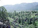
Query: G.N.I.S. See also: Pine Valley Mountains. | Pine Mountain, Washington County, Utah. | |
|
Not definately located and is perhaps Signal Peak or Burger Peak
in the Pine Valley Mountains.
1898.
Articles that refer to this location:
| ||
|
Query: G.N.I.S. See also: Pine Valley
Mountains. | Pine Valley, Washington County, Utah. | |
|
Along the Santa Clara River with the town of Pine Valley located at
37° 23'N, 113° 31'W. 1898.
Articles that refer to this location:
Letters that refer to this location: | ||
|
Query: G.N.I.S. See also: Cane Springs Mountains. Diamond Valley. Mountain Meadows. Pine Mountain. Pine Valley. Santa Clara Creek. | Pine Valley Mountains, Washington County, Utah. | |
|
Bounded by highway 15 on the south and east,
the Harmony Mountains on the northeast and highway 20 on the west.
1898.
Articles that refer to this location:
Letters that refer to this location:
| ||
|
Query: G.N.I.S. See also: Pioche
Hills.
Ely Range. Highland Range. | Pioche, Lincoln County, Nevada. | |
|
The county seat of Lincoln County and is located in the Pioche Hills
in TIN, R67E, S21 and at 37° 57'N, 114° 28'W.
1898.
Articles that refer to this location: | ||
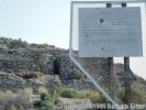
| Query: G.N.I.S. | Pioche Hills, Nevada. | |
|
Query: G.N.I.S. See also: Oasis. | Pipers, Esmeralda County, Nevada. | |
|
Somewhere near Oasis, California. I have placed Pipers in Nevada because of the presence of Piper Canyon and Piper Peak in the Silver Peak Range.
Letters that refer to this location:
| ||
|
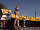
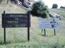
Query: G.N.I.S. See also: Erskine Creek. | Piute Mountain, California. | |
|
Query: G.N.I.S. See also: Piute Peaks. | Piute Mtns, California. | |
|
Articles that refer to this location:
Letters that refer to this location:
| ||
|
Query: G.N.I.S. See also: Erskine Creek.
| Piute Peak, Kern County, California. | |
|
In the Piute Mountains and reaching an elevation of 8318 ft.
T28S, R34E, S30 and 35° 28'N, 118° 22'W.
1897.
Articles that refer to this location: Letters that refer to this location: | ||
|
Query: G.N.I.S. See also: Piute Mtns. | Piute Peaks, California. | |
|
Letters that refer to this location:
| ||
|
Query: G.N.I.S. | Plancillo Mountains, Texas. | |
| In Texas? New Mexico? Purpus says they are near El Paso, Texas. | ||
|
Query: G.N.I.S. | Point Loma, San Diego County, California. | |
| 1898, 1899. | ||
|
Query: | Popocatepetle, , Mexico. | |
|
Letters that refer to this location:
| ||
|
Query: G.N.I.S. See also: Deer Creek. | Porterville, Tulare County, California. | |
|
On the Tule River downstream from Lake Success.
Centered about T21S, R27E, S25-26 and 36° 4'N, 119° 1'W.
1897, 1898.
Articles that refer to this location:
| ||
| Query: G.N.I.S. See also: Cedar Creek. Linns Valley. | Poso Creek, California. | |
|
Query: G.N.I.S. See also: Mendocino
County. Tom-Kay Creek. | Potter Valley, Mendocino County, California. | |
|
1895. Types described from this location: Articles that refer to this location:
Letters that refer to this location: | ||
|
A, B,
C, D, E, F, G, H, I,
J, K, L,
M, [Home Page] Date and time this article was prepared: 6/7/2002 7:34:18 PM | ||