


- Map Distribution
- Description
- eFlora Distribution
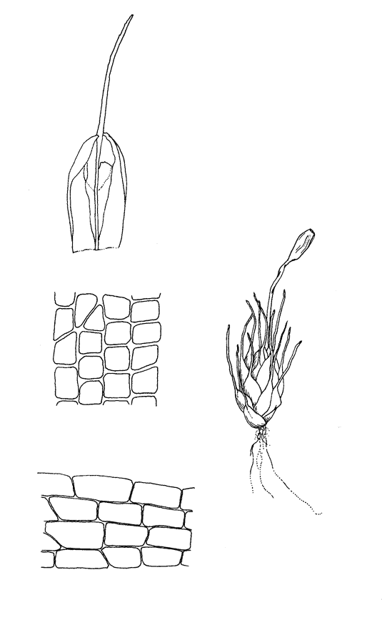
- Illustrations
- Cal Photos images
- Elevation by latitude plot
MAP CONTROLS
1. You can change the display of the base map and layers by clicking on the layer control box in the upper right-hand corner.
2. California county polygons can be turned off and on in the layer control box.
3. Filling of Jepson subdivision polygons can be turned off and on in the layer control box.
Database links
UC Specimens in the University and Jepson Herbaria Public Portal
Specimens of Pterygoneurum californicum in the Consortium of North American Bryophyte Herbaria portal (CNABH)
No Taxonomic Notes.
No Description.
Catalog Notes: This species, known only from the type collection, was obtained from an area that is now converted to a mix of urban and agriculture. We have not been able to recollect this species, however, suitable habitat in several nearby preserved landscapes may yet yield a new occurrence.
Vouchers: Kern Co.: alkali flats along Panama Lane, 5 miles west of Highway 99 near Bakersfield, Koch 4026 (MICH).
Literature: Crum 1967a.
Geographic subdivisions for Pterygoneurum californicum: GV. |
Illustration References: Crum 1967a.
No expert verified images found for Pterygoneurum californicum. |