- Map Distribution
- Description
- eFlora Distribution
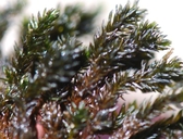
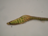
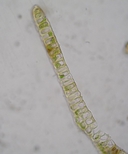
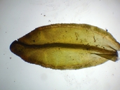
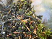
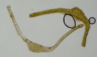
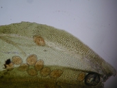
- Illustrations
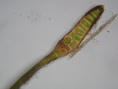
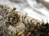
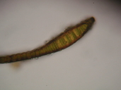
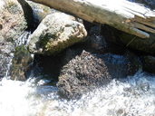
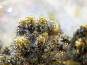
- Cal Photos images
- Elevation by latitude plot
MAP CONTROLS
1. You can change the display of the base map and layers by clicking on the layer control box in the upper right-hand corner.
2. California county polygons can be turned off and on in the layer control box.
3. Filling of Jepson subdivision polygons can be turned off and on in the layer control box.
Database links
UC Specimens in the University and Jepson Herbaria Public Portal
Specimens of Scouleria aquatica in the Consortium of North American Bryophyte Herbaria portal (CNABH)
No Taxonomic Notes.
No Description.
Vouchers: Amador Co.: below Devil's Lake Trailhead northeast of Bear River Reservoir, Eldorado National Forest, Norris 82699; Humboldt Co.: South Fork of Tish-Tang-a-Tang Creek east of Hoopa, Norris & Whittemore 52390; Inyo Co.: Big Pine Creek adjacent to Glacier Lodge Road, 0.4 miles below Sage Flat Campground, Inyo National Forest, Shevock 15323; Lake Co.: tributary of Stony Creek, west slope of Crockett Peak, Snow Mountain Wilderness, Mendocino National Forest, Toren & Dearing 7591 (CAS); Marin Co.: Mt. Tamalpais State Park, J.T. Howell s.n. (CAS); Mendocino Co.: South Fork Eel River, Branscomb Nature Conservancy Preserve north of Branscomb, Norris 47219; Siskiyou Co.: Klamath River at Ishi Pishi Bridge near Somes Bar, Klamath National Forest, Norris 12253.
Literature: Bourell 1981; Churchill 1985; Flowers 1973; Holmberg 1969; Howe 1897; Koch 1950a, 1951e, 1958; Koch and Ikenberry 1954; Lawton 1971; Showers 1982; Spjut 1971; Yurky 1990, 1995. As Grimmia scouleri Lesquereux 1868; Lesquereux and James 1884; Watson 1880.
Geographic subdivisions for Scouleria aquatica: CaR, CW, NW, SN, SNE. |
Illustration References: Malcolm et al. 2009 p. 53; Brotherus 1924-25; Flowers 1973; Lawton 1971.

|