- Map Distribution
- Description
- eFlora Distribution
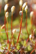
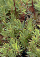
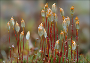
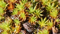
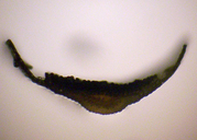
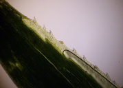
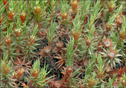
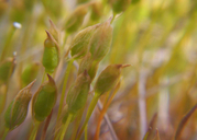
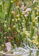
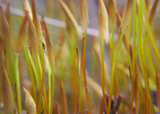
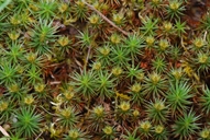
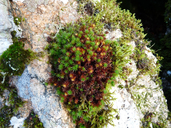
- Illustrations
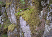
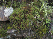
- Cal Photos images
- Elevation by latitude plot
MAP CONTROLS
1. You can change the display of the base map and layers by clicking on the layer control box in the upper right-hand corner.
2. California county polygons can be turned off and on in the layer control box.
3. Filling of Jepson subdivision polygons can be turned off and on in the layer control box.
Database links
UC Specimens in the University and Jepson Herbaria Public Portal
Specimens of Polytrichum juniperinum in the Consortium of North American Bryophyte Herbaria portal (CNABH)
No Taxonomic Notes.
No Description.
Vouchers: Del Norte Co.: Forest Road 4803, Siskiyou National Forest, Norris 70904; San Francisco Co.: Glen Canyon, San Miguel Hills, Shevock 18882 & 18892; Santa Barbara Co.: water Canyon, Santa Rosa Island, Channel Islands National Park, Shevock & Rodriquez 20808; Santa Cruz Co.: Highway 9 about 1.5 miles north of Boulder Creek, Norris 55572; Siskiyou Co.: Soda Creek road about 4 miles northeast of Interstate 5 near Dunsmuir, Shasta-Trinity National Forest, Norris 84810; Sonoma Co.: South Ridge Trail above Lake Sonoma at Skaggs Springs Road, Norris 86916; Tulare Co.: Grapevine Grade along County Road M-15, between White River and California Hot Springs, Shevock 6766.
Literature: Bourell 1981; Cooke 1941; Harpel 1980a; Harthill et al. 1979; Holmberg 1969; Ireland 1982; Jamieson 1969; Kellman 2003; Koch 1950a, 1951e, 1958; Koch and Ikenberry 1954; Lawton 1971; Lesquereux 1868; Long 1978; McGrew 1976; Shevock and Toren 2001; Showers 1982; Smith 1970; Spjut 1971; Strid 1974; Sullivant 1856; Toren 1977; Watson 1880; Yurky 1990, 1995.
Geographic subdivisions for Polytrichum juniperinum: CaR, CW, MP, NW, SN, SNE, SW. |
Illustration References: Malcolm et al. 2009 p. 38; Flowers 1973; Ignatov and Ignatova 2003; Ignatov and Smith Merrill 1995; Ireland 1982; Lawton 1971; Ochyra 1998a; Sharp et al. 1994; Smith 1971, 1978.

|