- Map Distribution
- Description
- eFlora Distribution
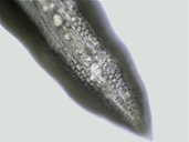
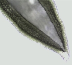
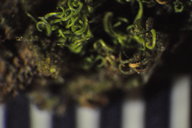
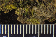
- Illustrations
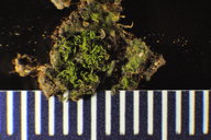
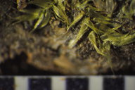
- Cal Photos images
- Elevation by latitude plot
MAP CONTROLS
1. You can change the display of the base map and layers by clicking on the layer control box in the upper right-hand corner.
2. California county polygons can be turned off and on in the layer control box.
3. Filling of Jepson subdivision polygons can be turned off and on in the layer control box.
Database links
UC Specimens in the University and Jepson Herbaria Public Portal
Specimens of Weissia controversa in the Consortium of North American Bryophyte Herbaria portal (CNABH)
No Taxonomic Notes.
No Description.
Vouchers: Del Norte Co.: between Requa and False Klamath Cove, Redwood National Park, Norris 24048; Lassen Co.: Highway 138 about 3 miles north of Susanville, Norris 52793; Marin Co.: junction of Bolinas-Fairfax Road and Highway 1, Golden Gate National Recreation Area, Yurky 677 (SFSU); Riverside Co.: El Cariso Campground, Cleveland National Forest, Norris 58095; Trinity Co.: New River between Denny and Mills Creek, Norris 23941; Tulare Co.: Forest Trail 33E20 toward the Forks of the Kern River, Golden Trout Wilderness, Sequoia National Forest, Shevock 14269.
Literature: Bourell 1981; Crum and Anderson 1981; Harpel 1980a; Harthill et al. 1979; Holmberg 1969; Jamieson 1969; Kellman 2003; Koch 1950a, 1951e, 1958; Koch and Ikenberry 1954; Lawton 1971; McCleary 1972; Mishler 1978; Shevock and Toren 2001; Showers 1982; Sigal 1975; Strid 1974; Toren 1977; Whittemore and Sommers 1999; Yurky 1990, 1995. As Weissia viridula Brandegee 1891; Kingman 1912, Lesquereux 1868; Steere 1954; Steere et al. 1954; Sullivant 1856; Watson 1880.
Geographic subdivisions for Weissia controversa: CW, MP, NW, SN, SW. |
Illustration References: Malcolm et al. 2009 p. 160; Allen 2002; Crum and Anderson 1981; Ignatov and Ignatova 2003; Ireland 1982; Lawton 1971; Sharp et al. 1994; Smith 1978; Stoneburner 1981; Zander 1993.

|