|
|
|||||
| University of California, Berkeley | |||||
| Directory News Site Map Home | |||||
|
Home · List of Genera · Key to Keys · Accepted Names · Synonyms · For Beginners · See also .... Subdivisions of CA — Jepson eFlora for CA Vascular Plants — Specimen records — Elevation by latitude plot — Tropicos nomenclature — Cal Photos images — Bryophyte Flora of North America — Google Scholar | ||
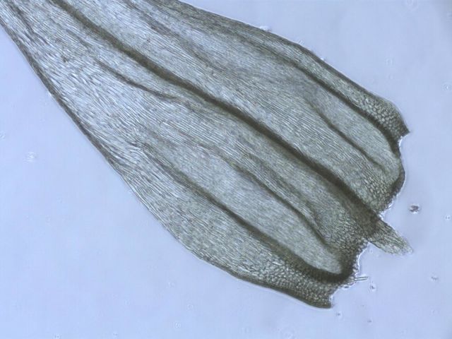
| Homalothecium arenarium (Lesquereux) E. Lawton [Brachytheciaceae] | ||
|---|---|---|
 |
 |
|
| photo by Sagar 290 |
| Literature | Harthill et al. 1979; Jamieson 1969; Kellman 2003; Lawton 1965a, 1971; Long 1978; McCleary 1972; Shevock and Toren 2001; Spjut 1971; Whittemore and Sommers 1999; Yurky 1990, 1995. As Camptothecium alsioides Kindberg 1892; Koch 1950a; Steere 1954. As Camptothecium arenarium Howe 1896; Kingman 1912; Koch 1950a; Millspaugh and Nuttall 1923; Sayre 1940; Steere 1954. As Hypnum arenarium Brandegee 1891; Lesquereux 1868; Watson 1880. |
| Illustrations | Malcolm et al. 2009 p. 263; Lawton 1965a, 1971; Sharp et al. 1994. |
| Bioregions | CaR, CW, NW, SN, SW. |
| Vouchers | Lake Co.: base of Mt. Konocti, Clear Lake State Park, Toren 7039 (CAS); Mariposa Co.: Moss Canyon near El Portal, Yosemite National Park, Norris 80894; Riverside Co.: Mesa de Colorado, Santa Rosa Plateau Preserve west of Murrieta, Weber, Bratt & Larson 91958 (UC); San Francisco Co.: Baker Beach, Presidio of San Francisco, Shevock 18948; Santa Barbara Co.: Water Canyon east of Black Mountain, Santa Rosa Island, Channel Islands National Park, Shevock & Rodriquez 20819; Sonoma Co.: Wolf Creek Road about 4 miles east of Gualala River, Norris 86946; Tehama Co.: Highway 36 about 5 miles northeast of Red Bluff, Norris 48076; Tulare Co.: General's Highway at Four Guardsman, Giant Forest, Sequoia National Park, Rundel 3082 (UC). |
| Copyright © 2024 Regents of the University of California
We encourage links to these pages, but the content may not be downloaded for reposting, repackaging, redistributing, or sale in any form, without written permission from The University and Jepson Herbaria. |